Tropical Storm Isaias was one of the most powerful storms to strike the city since Sandy.
Isaias was one of the most bizarre tropical systems to plague the area in recent memory for one reason: its speed.
The morning on August 4, 2020 started quiet, but conditions quickly deteriorated, multiple tornadoes formed, and by the afternoon, the sun shined. Isaias knocked out power to millions in the area as the storm lunged forward through the region, exiting almost as quickly as it entered.
I was tag-teaming from my home studio that morning with the meteorologist who was in the studio.
We started the morning show live at 4 a.m. on what was supposed to be an 11 a.m. arrival of tropical-storm-force winds. Those winds arrived early, and with hurricane gusts.
In fact, as the new forecast track updated from the National Hurricane Center throughout the morning, the probability of tropical storm force winds increased from 50%, then to 70%, then finally to 90%.
I was watching my forecast become dated in real-time as a hurricane wind probability map was now superseding the tropical-storm-force wind map that I had been airing all morning.
Just as the new and more powerful forecast was “locked in” and we warned viewers of ferocious, hard-hitting winds, the live reporters on scene showed a very different picture. That summer morning offered a calm, tranquil, and almost picturesque sunrise.
If the average person stepped outside that morning, they would never have known that 80 mph or greater winds would soon follow.
I found it difficult to convey that the flooding threat was no longer an issue. In past tropical systems, our area got doused by inches of tropical rains, with the resulting flooding doing most of the damage.
Due to the unique path of Isaias, the several inches of flooding rains would stay well inland, while the wind would be the more imminent threat. The National Hurricane Center’s storm archive on Isaias clearly laid out a wind threat.

Just as Isaias’s outer bands were reaching the shoreline, I began to notice a feature on radar that was common with tropical systems, but not one that we experience all that often here. Each band contained storm cells with significant rotation, indicating waterspouts.
These waterspouts were all moving onshore, and fast. One after one, the waterspouts made landfall, becoming tornadoes. Two of these twisters were even captured on video.
In total, seven tornado warnings were issued that day for rotating cells in the New York and New Jersey area. Isaias produced dozens of tornadoes in total including Maryland, Pennsylvania, and Connecticut.
One of these small tornadoes quite notably passed over a personal weather station in NJ, which reported a 109 mph wind measurement. While that would equate to an EF1 tornado, actual wind speeds don’t determine tornado intensity, The resulting damage does.
Here’s a more detailed explanation of the EF wind scale.
For the areas that didn’t see tornadoes, the straight-line wind gusts were still impressive. The New York office of the National Weather Service created this storm synopsis page, highlighting the worst of Isaias’ effects.
In an age of social media, when my on-air shift was nearly done, and most of the storm damage had finished, I took to Facebook Live to interact with the same viewers who were watching on TV until their power went out.
ConEd reported that the damage to the grid was the worst since Sandy. My office lights even flickered during my Facebook Live, only to be saved by a battery backup that kept the livestream going.
The stream was flooded with comments about trees down, power being out, and how the wind was far worse than they had expected.
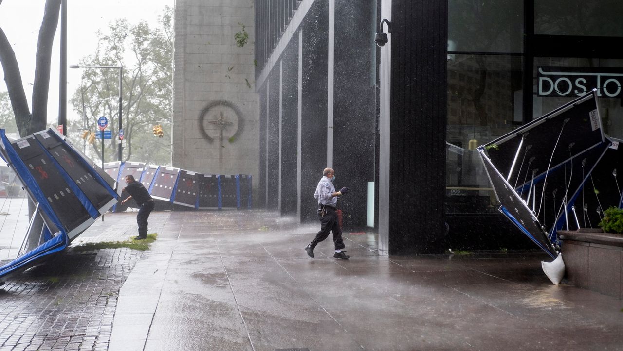
People try to secure barriers meant to block flood waters that were picked up by the wind in lower Manhattan Tuesday, Aug 4, 2020, as Tropical Storm Isaias blew through the city. (Craig Ruttle/AP Photo)
Tropical storm, tornadoes, plus a pandemic was a combined first for the area. The evidence was in the extra debris from temporary outdoor seating structures. Refrigeration loss and food spoilage added to the pain of restaurants already in a financial hardship.
Usually cautious with my words, I felt no remorse from earlier that morning, comparing the destructive potential of Isaias to that of a full-fledged hurricane.
While storm surge wasn’t an issue (remember, surge was the most devastating part of Sandy), Isaias’ short-lived, but intense, winds made us respect tropical storms a bit more.
The Link LonkNovember 25, 2020 at 04:00AM
https://www.ny1.com/nyc/all-boroughs/weather/2020/11/24/a-fast-and-hard-hitting-storm-for-our-area
Isaias: A Fast and Hard-Hitting Storm for Our Area - Spectrum News NY1
https://news.google.com/search?q=hard&hl=en-US&gl=US&ceid=US:en

No comments:
Post a Comment